- 简体中文
- English
.jpg)
- Home
- > Product Display
- > Landscape Design Scheme for Guansheng Street Park in Luolong District, Luoyang C
Landscape Design Scheme for Guansheng Street Park in Luolong District, Luoyang C
- 商品
- 详情
产品详情
Landscape Design Scheme for Guansheng Street Park in Luolong District, Luoyang City
Luolong District is located in the east and south of Luoyang urban area. It is backed by 邙山, faces Yique, overlooks Songyue Mountain in the east, leans against Zhoushan Mountain in the west, is connected to yanshi City in the east, borders Yiyang County in the west, is adjacent to yichuan County in the south, and is bordered by Mengjin County and 瀍 river, laocheng, Xigong and Jianxi districts in the north. Luolong District was established in 2000 with the approval of The State Council as a new urban area. It is one of the six main urban districts of Luoyang City and also the economic, cultural, financial and commercial center of the entire city.
The planned area of Luoyang Big Data Industrial Park is approximately 3.8 kilometers wide from east to west and 1.3 kilometers long from north to south, with a total area of about 5.0 square kilometers. It is bordered by the Ancient City Road to the north, the Jiaozuo-Liuzhou Railway to the east, Longmen Avenue to the west, and Kaiyuan Avenue to the south.
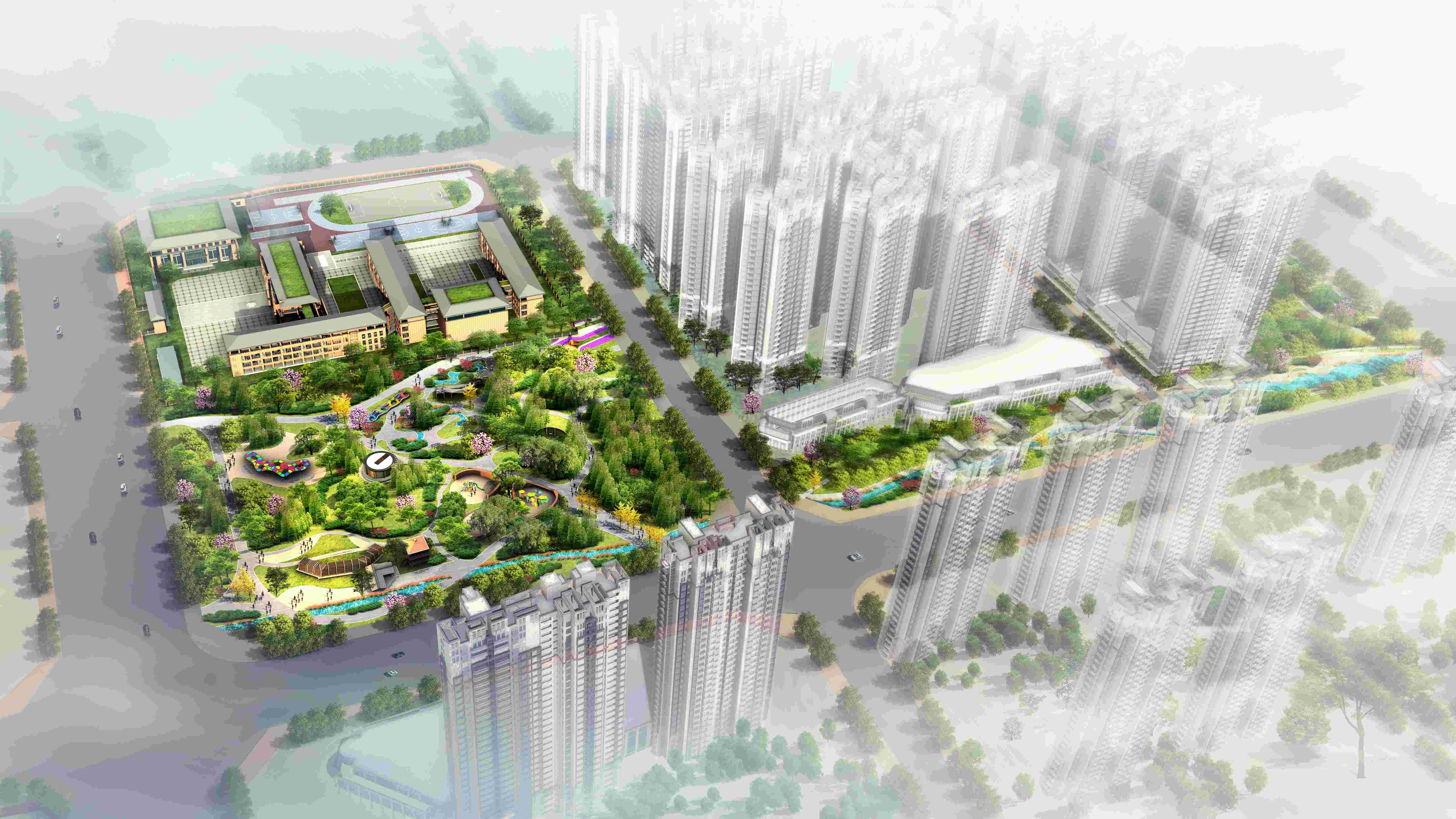
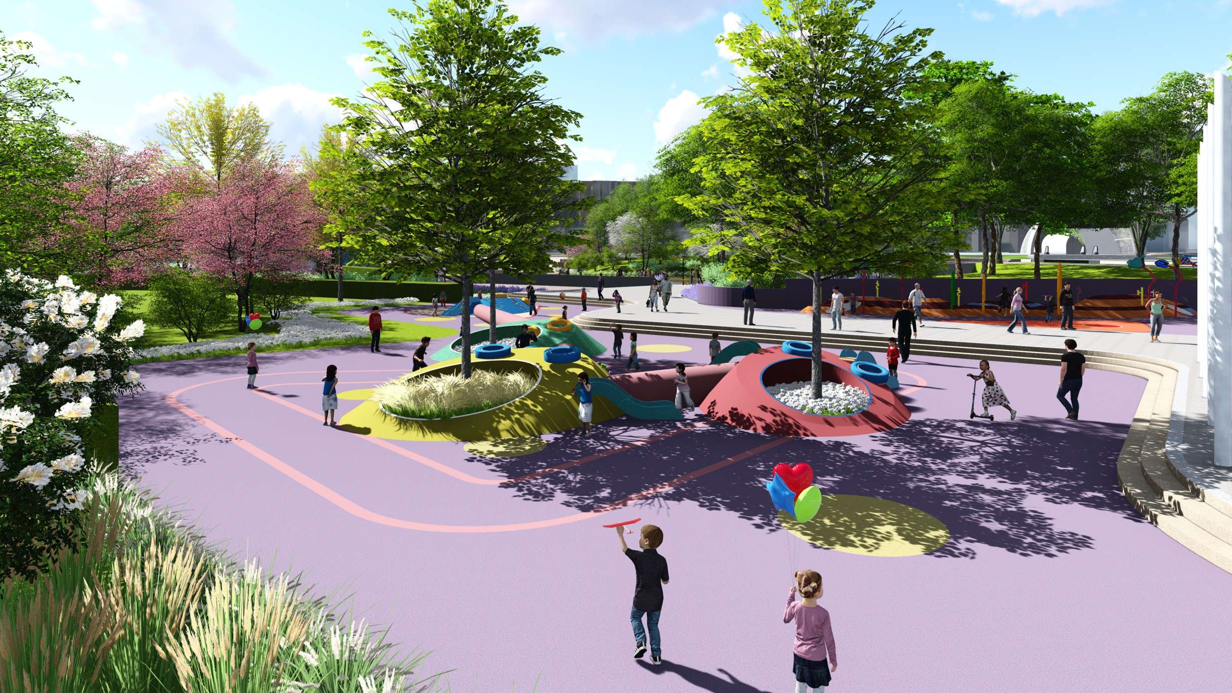
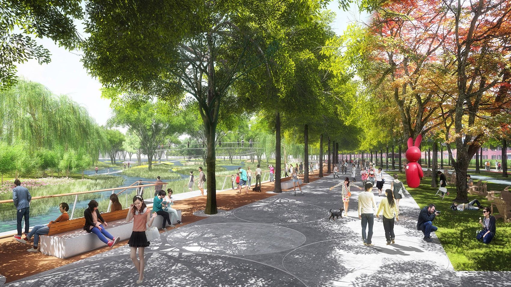
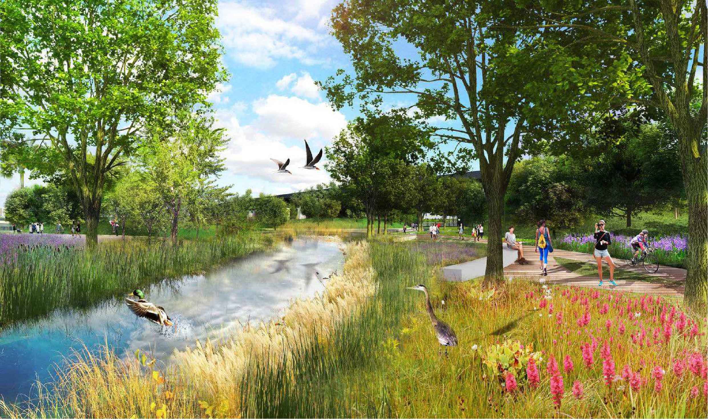
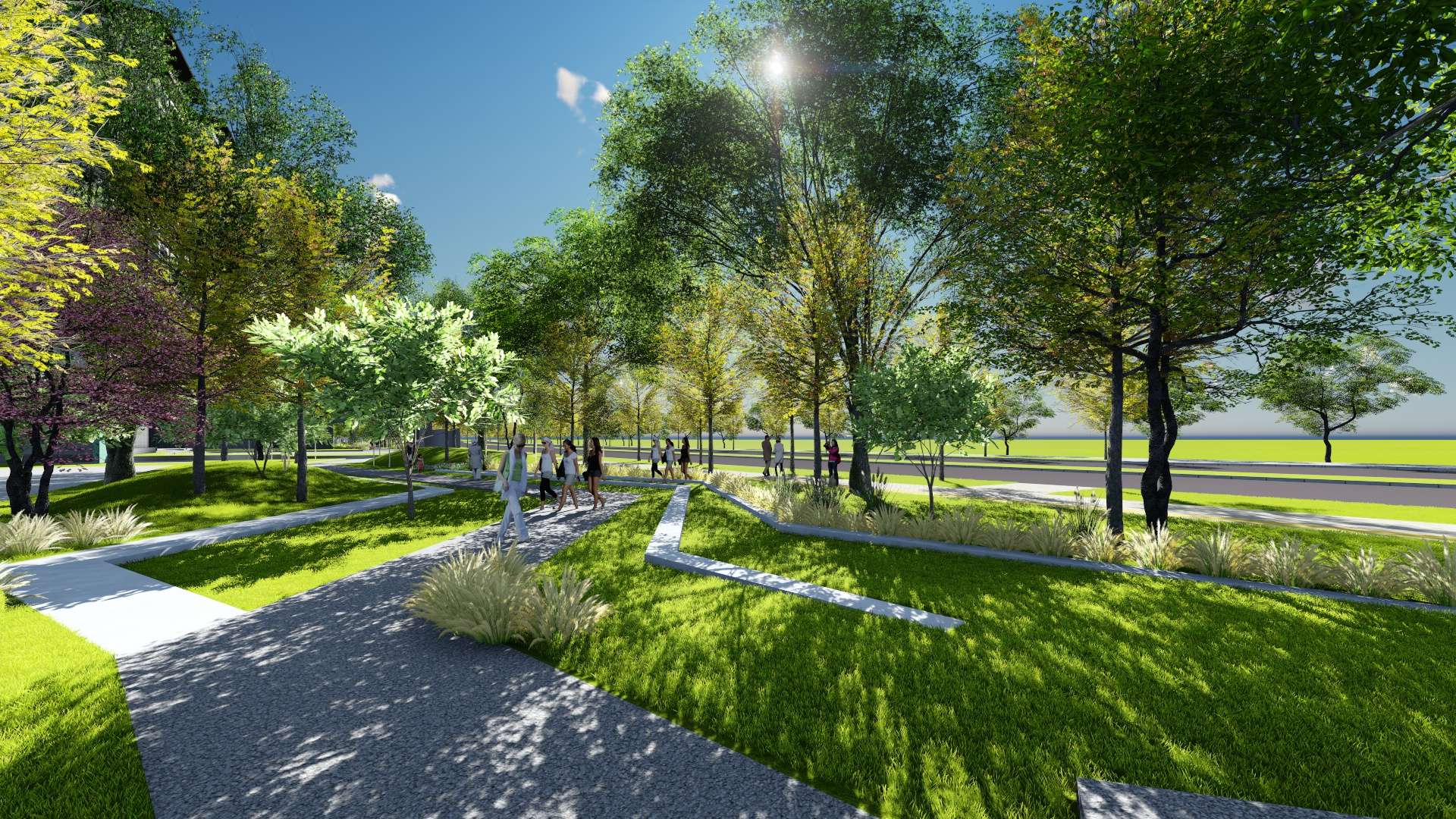
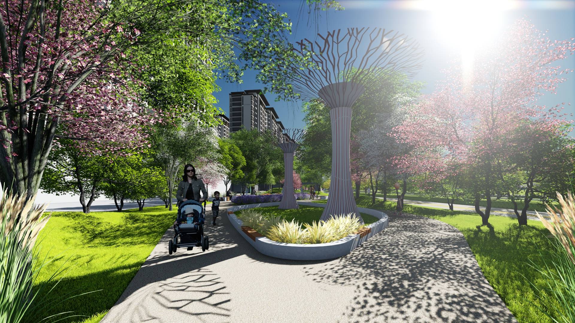
This planning project is located in the northwest of Luoyang Big Data Industrial Park, within the core area of the Cultural and Creative Core, in the section of Guansheng Street from Taikang East Road to the east of the ancient City. The total area is approximately 77.1 mu. The current surrounding supporting facilities such as roads are under construction. The green space in the ancient city Road area is relatively flat. The land in the Yiren Road area involves village demolition, and the demolition of the land on the south side has been completed. The terrain is relatively flat. There is construction transported soil piled up in the base, providing conditions for shaping a micro-terrain for the park construction.